


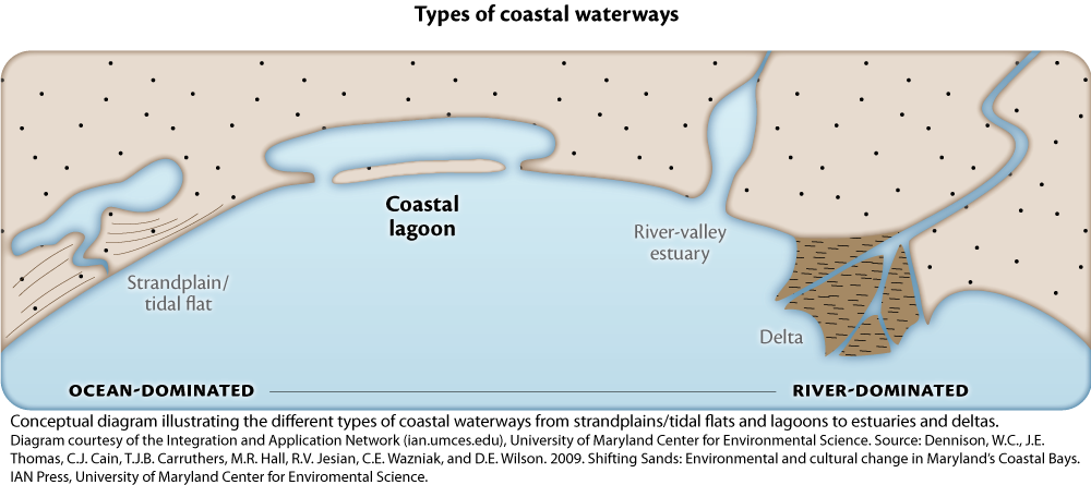
Are shorelines ever just straight lines? If you look at a Google Earth image of the Gulf coast, you notice many indentations reaching into the mainland and islands occurring just offshore. The indentations are our estuaries, the islands are barrier islands and together they create important habitats known as back bays or lagoons.
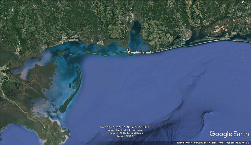
Estuaries are coastal environments where fresh and salt water meet to create a dynamic, intermediate or brackish water environment. Most of the estuaries along the Gulf coast formed over the past 5000 years following a period of sea level rise and are categorized as coastal plain or drowned river valley estuary. The islands you see are the chain of barrier islands that occur relatively close to the mainland. And while the geologic origin of Gulf coast barrier islands is a bit less clear, they can also be traced back to that same period of sea level rise.
The result of these geologic features is a series of semi-protected aquatic environments all along the Gulf of Mexico coast. These areas have been alternatively called estuaries, back bays and lagoons. In fact, the Gulf of Mexico is estuary-rich with close to 40 estuaries occurring along its shoreline from the Yucatan peninsula to the west coast of Florida. The Gulf owes much of its productivity to these important environments.
The estuaries, back bays and lagoons of the Gulf region are all relatively shallow but vary dramatically in size, in the amount of river water and precipitation they receive and the prevailing climate1. As a consequence, they also vary in salinity and the time the water stays in the area before flowing to the larger Gulf, known as the residence time (the time the water is in residence in the system). In the hot Texas climate with low levels of river discharge (typically less than 100’s of cubic meters per sec (m3/s)) such that evaporation is greater than water inflow, lagoons are often hypersaline - that is saltier than even the open ocean. In contrast, Mobile Bay is ranked the 4th largest in North America by freshwater inflow, receiving 1000’s of m3/s, from the many rivers through the almost 44,000 square mile Mobile Bay watershed. During the high flow periods of spring, the Mobile Bay estuary can be fresh at its head and only brackish by the time water flows from the estuary mouth to the Gulf of Mexico. Residence times thus also vary from 100’s of days in some Texas lagoons to less than a week in Mobile Bay and other river dominated estuaries during spring flows.
These lagoons, back bays and estuaries are incredibly important and dynamic habitats. They are typically shallow allowing a great deal of interaction between the bottom muds and what’s happening in the water itself. They are typically surrounded by wetlands – marsh and mangrove habitats that act as important nursery habitat for many marine organisms and affect many processes occurring in the water. Many critical biogeochemical reactions occur in these transition zones – nitrification, denitrification, decomposition and others. And they are usually characterized by complex and dynamic circulation patterns. This circulation affects nutrient distributions, larval and adult animal movements, feeding patterns, and of course, distribution of waterborne pollutants such as oil. And these areas are incredibly dynamic. Conditions change interannually - varying between wet and dry years, they change seasonally, and can change in a matter of days and hours as tides and winds change.
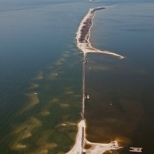
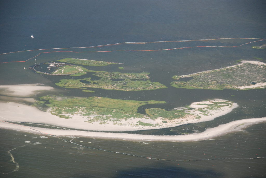
As an example of their importance, the federal government took extraordinary measures to try and protect the back bay area known as Mississippi Sound. This action closed the mile and a half wide gap in Dauphin Island that had allowed direct exchange between the Gulf and the Sound immediately after the Deepwater Horizon event. In the Chandeleur Island area, the federal government authorized the construction a large sand berm just north and east of the island chain. The ACER Consortium is researching possible impacts of the spill in these environments by focusing on one of these important back bay areas – the Chandeleur Islands.
[1] Hydrography, mixing characteristics and residence times of Gulf of Mexico estuaries. pp 29-62. In Biogeochemistry of Gulf of Mexico Estuaries. 1999. Bianchi, T., J. Pennock and R. Twilley (eds.)
©2015 Dauphin Island Sea Lab